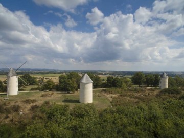
Circuit pédestre le sentier des Meuniers
The Meuniers trail takes you up to Moulins hill for a walk through nature and heritage.
At the start of the walk, near the town hall, you'll see the church and the Clemenceau de Lattre Museum. Then along the way: the wash-house, the 18th-century fountain and the stele in memory of Marshal de Lattre.Along the way, a superb panorama from the Moulins hill. Look out for the flora and fauna along the way.
A "coup de coeur" trail.
Starting point: near the Town Hall, 2 rue de la Fontaine in Mouilleron-Saint-Germain
Signposts: yellow - anticlockwise
Elevation gain: 145 m
Practical information
Departure town
MOUILLERON-SAINT-GERMAIN
Arrival town
MOUILLERON-SAINT-GERMAIN
Distance
7.2 Km
Means of transport
Walking, difficulty level: Average, duration: 2h
Ascent
uphill 145m
downhill 145m
Colour of tag
jaune
Type of road surfacing
91%% on dirt road
Documents to be downloaded
Access map, location
Marais Poitevin : 40 km
Puy du Fou : 32 km
Sea side : 64 km
Contact Circuit pédestre le sentier des Meuniers
For further information, please contact the service provider directly by completing the form below